Botswana regional profile, Botswana, 2022
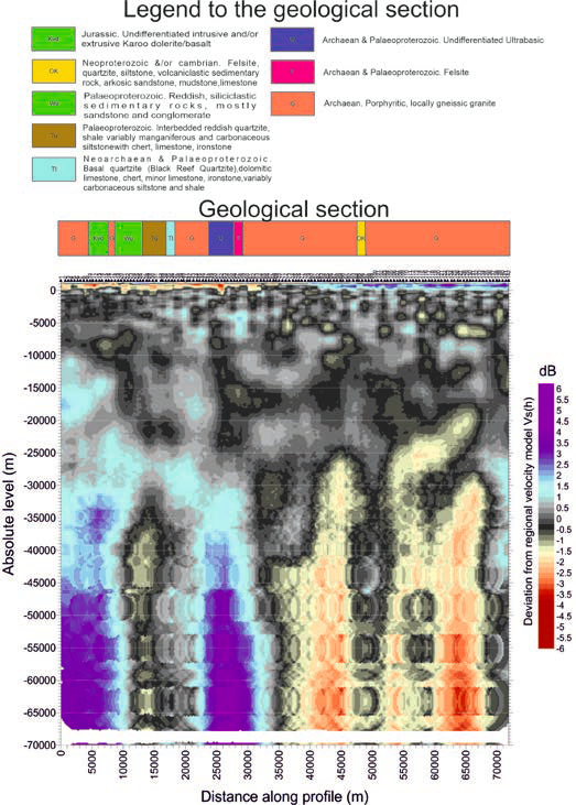
In a significant collaboration with the esteemed Botswana Geoscience Institute, an extensive and thorough investigation was conducted into the intricate structural complexities of regional fault systems and magmatic channels. This joint effort carried a dual-fold purpose, aiming to shed light on critical geological phenomena and potential resources beneath the Earth’s surface.
One of the key objectives of this venture was to delve deep into the geological makeup, seeking to uncover the underlying geodynamics that unfold at substantial depths and subsequently manifest as events on the Earth’s surface. By comprehending the intricate processes that shape our planet from within, this study sought to offer a more profound understanding of the interconnectedness between subterranean activities and surface-level occurrences.
Furthermore, the collaborative study aspired to identify areas with promising potential for rich mineral deposits. These meticulously singled-out zones held the promise of becoming focal points for more intensive and comprehensive exploratory efforts. The comprehensive investigation aimed to provide resource exploration initiatives with critical insights that could potentially lead to the discovery of valuable ores and minerals.
In essence, this collaborative endeavor was a testament to the dedication of scientists and researchers in unveiling the enigmatic layers of our planet’s geological framework. The study’s ultimate aspiration was to enhance our understanding of Earth’s hidden treasures while refining strategies for resource exploration in the pursuit of knowledge and sustainable development.
Dam on Mekong river, Loas, 2018
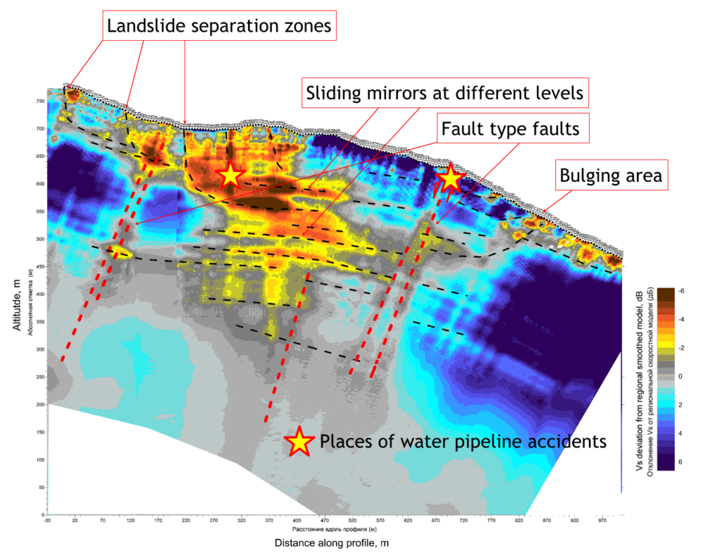
Since 2012, ruptures of the supply conduits began to occur at the hydro power station. The operation of the hydroelectric power station was stopped, and VietLaoPower suffered heavy losses. Several previous surveys could not provide reliable information about the nature of the ongoing processes.
As a result of the Microseismic Sounding research, a detailed geological and geophysical cross-section was compiled to a depth of up to 450 meters, visualizing separation zones, multi-tiered slickensides, a bulging zone of a landslide slope, and water infiltration within the rock mass.
The sliding area of the landslide and its size (around 1.5 million tons) were determined. This determination allowed for predicting the behavior of the landslide over an extended period and preparing engineering solutions to ensure the smooth operation of the HPP.