Introduction
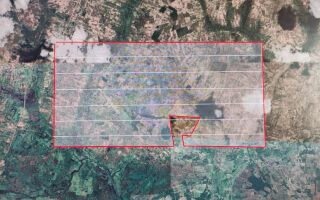
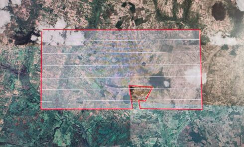
In 2023-2024, an exploration survey was conducted at the Ore Gold Licence in northeastern Tanzania, a site spanning over 10 million square meters. The survey aimed to uncover promising gold deposits using an innovative geophysical method known as Geological Exploration Microseismic Sounding (GEMS). This case study explores how GEMS technology was successfully applied to increase the precision of gold prospecting in a challenging geological environment.
Challenge
Traditional gold exploration methods often require extensive and costly drilling to locate ore deposits, which is not only resource-intensive but also environmentally invasive. The challenge at the Ore Gold Licence site was to reduce these costs and minimize environmental impact while still conducting an effective exploration of a vast, uncharted area.
Preliminary findings suggested that past magmatic activity might have created geological conditions favorable for gold deposition. However, accurately identifying specific zones of interest required a more advanced method that could visualize subsurface structures without extensive drilling.
Solution: GEMS Technology
To address this challenge, the exploration team implemented the GEMS (Geological Exploration Microseismic Sounding) method. GEMS is a passive seismic prospecting technique that uses the natural microseismic activity of the Earth to detect areas of varying seismic wave velocities.
This method is particularly well-suited for identifying zones of increased fluid conductivity, micro-cracking, and quartz enrichment—key indicators of potential gold ore deposits. GEMS works by analyzing how microseismic waves travel through the subsurface and identifying areas where the waves slow down, which may indicate fractures or occlusions associated with gold deposits.
Methodology
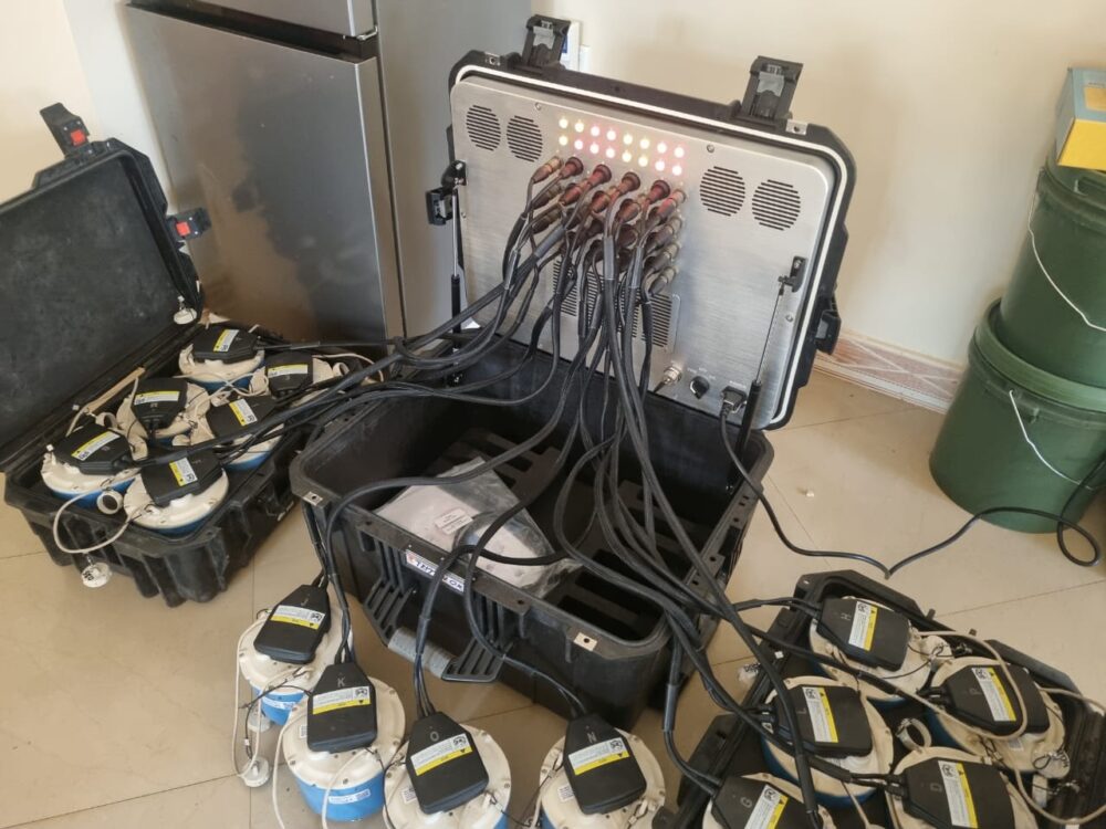
1. Survey Scope: The survey covered the entire 10,097,000 square meters of the Ore Gold Licence. A total of 1,690 data points were measured, with each point recording microseismic signals for at least six hours.
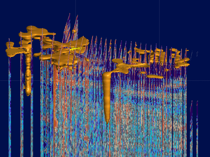
2. Data Collection: The microseismic signals were processed to create a 3D model of the subsurface, revealing the spatial distribution of seismic wave velocities down to a depth of 4.5 kilometers.
3. Data Interpretation: The results were visualized in the form of a layered depth distribution model, highlighting zones of reduced seismic wave velocities. These areas were interpreted as zones of increased fracturing and fluid movement, which are highly correlated with gold-bearing structures.
Key Findings
– Identification of Vertical Structures: The GEMS data revealed several vertical structures resembling magmatic roots, with wider zones near the surface. These structures are consistent with secondary magmatism, where fluid escapes toward the surface, potentially carrying gold deposits.
– Narrowed Exploration Focus: The 3D model allowed the team to pinpoint specific zones of interest for further exploration, significantly narrowing down the areas that require costly drilling. This improved both the accuracy and cost-effectiveness of the exploration efforts.
– Promising Zones for Drilling: The areas identified through GEMS are now prime candidates for targeted drilling, significantly reducing the amount of trial-and-error usually involved in gold exploration.
Outcome and Impact
By applying GEMS technology, the exploration team at the Ore Gold Licence site achieved several key outcomes:
– Cost Reduction: The ability to focus drilling efforts on promising areas has the potential to save millions of dollars in exploration costs.
– Environmental Sustainability: The passive nature of the GEMS method reduced the need for invasive drilling, minimizing the environmental footprint of the exploration project.
– Enhanced Accuracy: The detailed 3D model provided valuable insights into the subsurface, allowing for more informed decision-making and reducing the risk of unproductive drilling.
Conclusion
The application of GEMS technology at the Ore Gold Licence in Tanzania has proven to be a game-changer in gold exploration. By leveraging advanced geophysical methods, the exploration team was able to identify high-potential zones more accurately, reduce costs, and minimize environmental impact. This case study demonstrates how innovative technologies like GEMS can transform the way we approach resource exploration, making it more efficient, cost-effective, and sustainable.
As the next phase of exploration begins, which involves targeted drilling in the identified zones, the full potential of the Ore Gold Licence is yet to be realized. However, the success of the GEMS survey has already set a new standard for gold exploration in challenging environments.